
Key takeaways:
- A digital twin is only as good as the data feeding it, so most of the effort should go into a robust data integration workflow.
- The most durable digital twins are a byproduct of centralizing data that already exists in scattered systems.
- Real-time value depends on a pipeline that can ingest, standardize, validate, and route streaming data at scale, which is where FME comes in.
- AI and Augmented Reality are extending twins from dashboards to the field.
A digital twin is a virtual representation of a physical thing that stays connected to it through a live data feed. The 3D model everyone pictures is the visible result of a much bigger project: getting data out of incompatible systems, aligning it in space and time, checking its quality, and keeping it current.
That behind-the-scenes work is where a data integration platform comes in.
Let’s look at some real-world digital twins built using FME, including airports, heavy industry, pipelines, transport planning, a public event, and a historic ship.
Seeing utilities through the tarmac: Philadelphia International Airport
At Philadelphia International Airport, field inspectors use FME Realize to view underground utilities in augmented reality on an iPad, effectively seeing the pipes and manholes beneath their feet. They can tap an asset to pull up its inspection record, add a note, and have it sync straight back to ArcGIS Online.
This closes the loop many twins leave open. A model tells you what should be underground, while AR lets a crew confirm what actually is, and fix the record on the spot. Because FME Realize connects to existing FME workflows, the same pipelines that build the twin deliver it to the field and carry corrections back, turning the twin into something workers improve rather than just consult.
Read more: Philadelphia International Airport leads with FME Realize utility innovation
Bringing a 5-square-kilometre steelworks to life: voestalpine
Voestalpine’s steel site in Linz, Austria, spans roughly five square kilometres, with a rail network on the order of 130 kilometres and hundreds of kilometres of pipelines, some of it more than 80 years old and never documented in modern formats, which is the situation most industrial operators face.
The team built a unified GIS integrating 3D models of very different formats and detail levels into one continuous digital campus. FME handled the format conversion that made this possible while preserving the attributes that matter for planning and maintenance, staff can open documents directly through the model, and the next phase folds in sensor data. In heavy industry, the hardest input is often the oldest.
Read more: How voestalpine brought their industrial site to life with a digital twin
A synchronized environment: San Francisco International Airport
At San Francisco International Airport, the GIS team treats the twin as the natural result of doing integration well. Location data underpins nearly everything at SFO, from asset positions to real-time parking and passenger movement, spread across many separate business systems. Using FME to automate workflows and standardize that data, the team keeps a single synchronized environment that functions as the airport’s twin.
Pulling real-time data from different systems into one environment is what powers the twin, and that same connected data reaches every passenger who checks a wait-time board or finds a gate. The twin is the result of keeping scattered operational data centralized and in sync.
Read more: San Francisco Airport centralizes critical data into an FME-powered digital twin
A digital twin of an event: SAIL Amsterdam
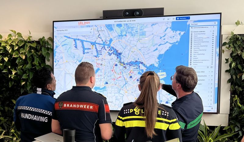
SAIL Amsterdam is the sharpest counter-example to the idea that twins are only for buildings. SAIL is one of the world’s largest maritime events, drawing huge crowds and heavy water traffic. For 2025, the Amsterdam-Amstelland Security Region worked with Safe Software partner Avineon Tensing to build a twin of the event itself: a real-time operational picture across land, water, and air that every safety partner could act on.
The challenge is that the subject is transient. Static site data was read straight into the visualization platform, while live sources flowed through FME:
- Vessel positions from AIS and radar, with the tall ships specifically designated
- Crowd-monitoring data from cameras and mobile devices
- Safety data such as emergency vehicle locations and active incidents
Incoming data arrived in many formats and coordinate systems; FME standardized it and converted the real-time streams into formats the display could consume, keeping pace with fast-changing conditions. Responders could then manage risks like overcrowding and heat stress proactively. A twin needs a live connection to something real.
Read more: Building a digital twin for proactive crowd management during SAIL: Amsterdam’s largest event
Pipeline safety with AI: Plains Midstream
Plains Midstream, running a large pipeline network across North America, also incorporates AI/ML work. The team uses FME for real-time integration and validation across pipeline safety, trucking logistics, wildfire monitoring, and one-call locate requests, and the AI angle is practical rather than speculative:
- FME’s AI capabilities generate GeoJSON that is immediately spatialized, validated, and delivered.
- FME paired with OpenAI runs iterative tasks in bulk, saving and processing responses together to cut manual effort.
For asset-heavy operations where a single failure carries enormous cost, validated real-time data plus AI-assisted processing is a preview of how twins will increasingly work.
Read more: Ensuring pipeline safety and efficiency with FME at Plains Midstream
A clear business case: Auckland Transport
Auckland has about 1.7 million people, projected to reach 2.2 million within 30 years, straining its transport network. With Auckland Council and Safe Software partner Locus, the agency built the Roads and Streets Framework (RASF) to guide how the network evolves, using FME to automate the assessments behind it.
The framework scores every road on two axes, Place (significance based on surrounding land use) and Movement (importance for moving people and goods), combining them into typologies that guide decisions on public transport, pedestrian safety, and freight. Automating those assessments with FME compressed work that once took years into months, feeding an interactive viewer that compares how a road functions today against how it might evolve. Years to months, on a live planning picture rather than a static report.
Read more: Auckland Transport automates planning from years to months with FME
What happens after launch: Vancouver International Airport
Vancouver International Airport (YVR), one of the busiest in North America, has a mature digital twin. YVR’s IT group needed to handle a sprawling range of data, from GIS to complex infrastructure records, close to real time, and FME became the tool for translating it between formats, including LiDAR data for Sea Island, where the airport sits.
YVR improved operations and the passenger experience by combining real-time data with digital modeling, and keeps extending the twin toward further 3D projects and indoor-mapping data. Now, years after launch, the twins that keep paying off are set up to keep absorbing new data types.
Foundation first: Amsterdam Airport Schiphol
Amsterdam Airport Schiphol maintains more than 50,000 assets, and keeping them running meant pulling data from many departments into one GIS database. With Safe Software partner Vicrea, Schiphol used FME to integrate that data, enhance it, verify its quality, and distribute it, then linked real-time sensor data on top to provide the foundation for a twin.
That groundwork was not glamorous: before a prototype is even possible, someone has to compile the data, identify attributes, define spatial relationships, and validate everything, and Schiphol also needed flexibility to expose open APIs to developers. FME served as the ETL glue between geo platforms. The integration groundwork comes first; the twin is what the foundation eventually supports.
Read more: Amsterdam Airport Schiphol uses data integration to build the foundation for a digital twin
A digital twin to preserve history: HMS Victory
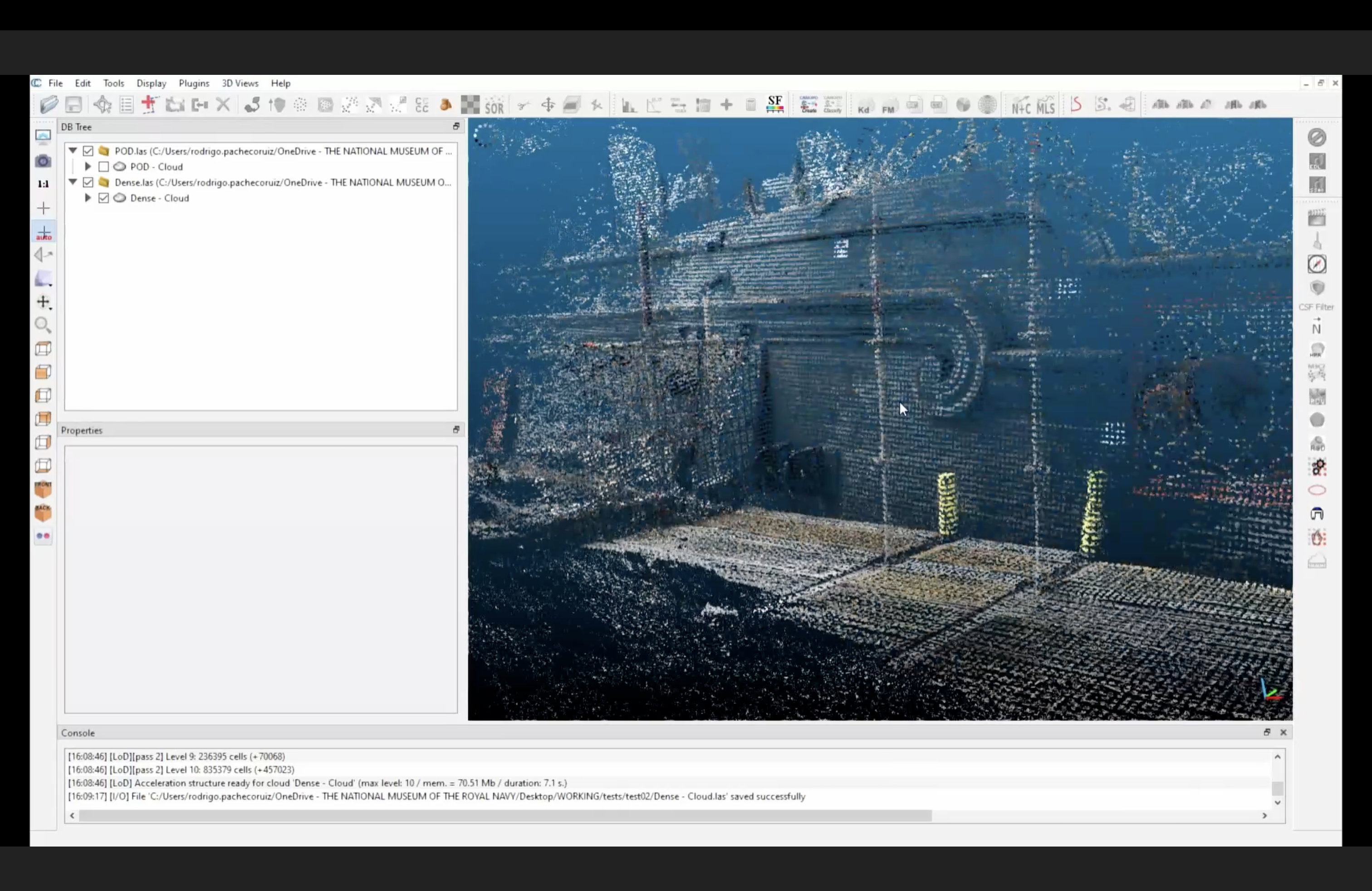
HMS Victory, launched in 1765 and Lord Nelson’s flagship at Trafalgar in 1805, is the oldest commissioned warship in the world, now undergoing one of the largest conservation projects of her life. The National Museum of the Royal Navy is documenting every structural change in meticulous detail.
The team chose FME to collect and standardize the data needed to reconstruct and document the work, building 4D models (three dimensions plus time) that let them examine repairs digitally without disturbing the ship’s historic fabric. A twin already exists, though changes are still entered manually; the aim is to use FME to automate the links between its Revit model, Rhino, and an SQL database so it stays current. A digital twin is not only for things being built, but for things that already exist and need to be preserved.
Read more: Restoring HMS Victory with 4D modelling and FME
What these nine stories have in common
Across an airport apron, a steelworks, a pipeline network, a city’s streets, a maritime festival, and a Georgian warship, the central project involves reconciling incompatible formats, aligning coordinate systems, validating data, and wiring up real-time feeds. The organizations that succeed treat the twin as an outcome of doing that integration well, design for streaming data from the start, plan to keep absorbing new data types, and build with AI and field AR in mind. Get the data foundation right, and the twin largely follows.
Learn more
- Digital Twin Examples (FME guide): concepts, types of twins, and the common challenges of building one
- FME Realize: how FME extends data and digital twins into augmented reality in the field
- FME customer stories: the full set of case studies behind the projects above
- Data integration for airports and aviation (FME): how airports use integration to build and feed twins
- Digital Twin Consortium: industry body publishing guidance and white papers on digital twin adoption