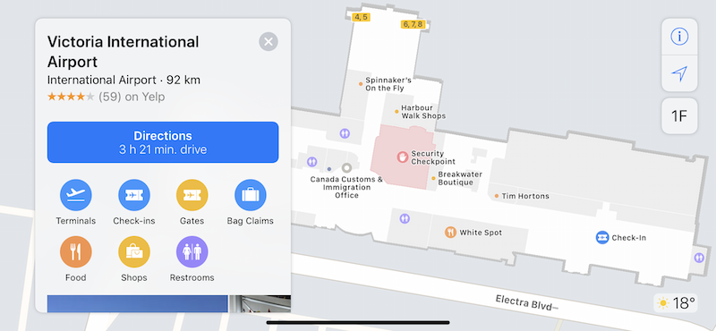
Victoria International Airport (YYJ) wanted to improve passenger experience by enabling indoor mapping via Apple Maps.
Using FME, they integrated their floor plans and facility information from Esri Geodatabase, and transformed it to meet strict IMDF (Indoor Mapping Data Format) requirements. After georeferencing, schema mapping, validation, and data conversion, the airport can now be navigated in Apple Maps.
 Passenger experience has been improved with this innovative wayfinding technology, and airport staff can easily track changing infrastructure on an up-to-date map.
Victoria International Airport is the 11th busiest airport in Canada with over 2.04 million passengers per year. Victoria is well served with more than 100 daily flights throughout North America. YYJ was rated among one of the top ten most-loved airports in the world by CNN Travel and was twice named ‘Best Regional Airport in North America’ by Airports Council International (ACI).


