This work was done in collaboration with Safe Software partner IMGS.

FME Presents: Your data at work.
For more than 30 years, this data team has asked the big questions, solved tough challenges, and sparked new ideas, proving they can do it all.
Meet Your Data Team


This work was done in collaboration with Safe Software partner IMGS.

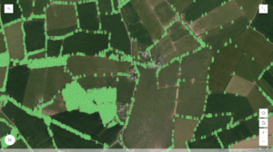
Waterford City & County Council is an administrative local government body in Ireland. They commissioned aerial photography of the city and county for the Bluesky National Tree Mapping Project. They aimed to incorporate tree data into their zoning development plans and boost conservation efforts.
Waterford first needed to establish a baseline for the trees around the city and county in terms of carbon planning. Using FME helped them better understand tree canopy coverage by overlaying and capturing data, and they established they had a 12% tree coverage, recording 7,743,563 trees. They next used FME to look at potential available land and overlay development planned zones to identify where more trees can be planted, helping them work towards reaching their tree coverage target of 20% in years to come.

Waterford streamlined processes and created a single source of truth within the organization, highlighting FME’s pivotal role in enhancing Waterford’s urban planning and environmental initiatives.
Watch our interview with Jon Hawkins, IS Project Leader at Waterford City & County Council, to learn more about the project and how they use FME.