![]()
This story was made in collaboration with Safe Software partner Consortech.
![]()
This story was made in collaboration with Safe Software partner Consortech.
Located in Central Ontario, the City of Peterborough uses GIS to manage property info, track assets, and support decision-making with geospatial data. The GIS team enables residents, visitors, and businesses to access information through maps and mapping technologies.
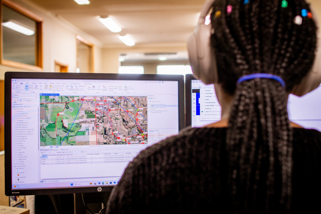
The City’s Geomatics/Mapping Division uses geocoding to maintain accurate address, road centerline, and point of interest data, utilizing address locator services in ArcGIS. Peterborough has 5 address locators integrated into its web mapping applications, allowing employees, residents, and stakeholders to search for specific locations.
The geocoding process was tedious and time-consuming. Each month, the GIS team manually ran workflows in ArcGIS ModelBuilder to update address locators and publish data to ArcGIS Portal. This repetitive task was prone to error, making it challenging to keep up with the growing demand for accurate, up-to-date information.
The city collaborated with Safe Software partner Consortech to leverage FME for geocoding process optimization. This partnership resulted in automated workflows, significantly reducing manual tasks and ensuring that the central database was consistently updated whenever changes to addresses, roads, and points of interest were made. The implementation also included scheduled tasks to maintain data accuracy and convert original processes into an FME Workspace.
The new process was deployed on FME Flow, allowing for seamless ArcGIS integration. This streamlined approach led to increased operational efficiency and improved performance across various departments within the city.
The GIS team now saves an hour per operation with the automation of geocoding, allowing them to concentrate on projects that boost innovation and efficiency. Furthermore, having access to current geospatial data results in better planning and a more adaptable city that is prepared for the future.