This work was done in collaboration with CapMetro.

FME Presents: Your data at work.
For more than 30 years, this data team has asked the big questions, solved tough challenges, and sparked new ideas, proving they can do it all.
Meet Your Data Team
This work was done in collaboration with CapMetro.
CapMetro, the public transit authority for the City of Austin and surrounding Central Texas region, has seen significant growth in both ridership and system complexity over the past decade. To meet the demands of this growing region, CapMetro has relied heavily on geospatial data and cutting-edge technology. One of their key challenges was streamlining their data management processes to provide real-time updates on transit operations while managing the vast amount of information generated by their systems.
To enhance operational efficiency, CapMetro adopted FME to automate data workflows, support geospatial analysis, and manage real-time data from multiple sources. This investment has significantly improved how CapMetro tracks and visualizes transit data, enhancing services and ensuring a smoother rider experience.
CapMetro’s transit operations generate vast amounts of data every second, particularly through the General Transit Feed Specification (GTFS) and real-time feeds that track vehicle locations and schedules. Integrating these feeds into CapMetro’s Geospatial platform is crucial for optimizing operations and providing accurate, real-time information to riders and staff.
Using FME, CapMetro automated the processing and integration of GTFS data, including stop locations, route information, and schedules. Automation has reduced the need for manual data handling, ensuring that the most up-to-date information is available across their platforms. FME also supports real-time data flows, connecting to various APIs to update vehicle locations every 10 seconds. This integration allows the public to access accurate, real-time updates about vehicle positions and transit schedules, improving rider experience.By utilizing FME, CapMetro eliminated the need for manual updates, reduced errors, and significantly sped up the delivery of accurate data across platforms, making it easier for riders to plan their trips and for staff to manage operations.
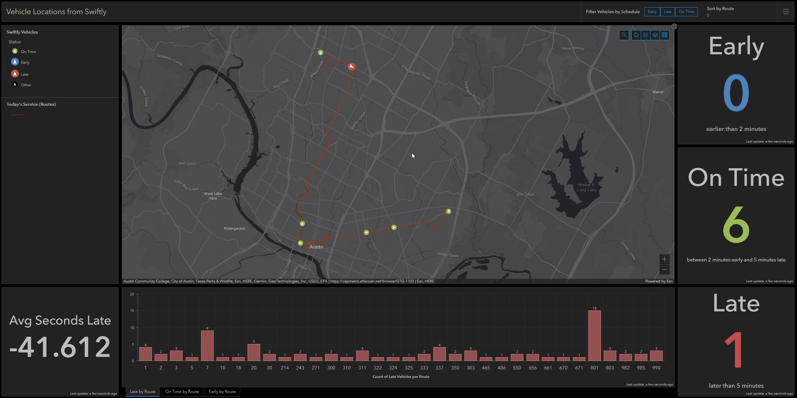 CapMetro vehicle locations from Swiftly’s API
CapMetro also leverages FME to transform and visualize data, helping transit planners and operational staff make informed decisions. One of their most significant projects involved automating the loading of GTFS data into ArcGIS Enterprise, allowing planners to visualize stop locations, routes, and other important transit data on maps and dashboards.
In addition to visualizing real-time operations, CapMetro also created dynamic layers that calculate and display “Today’s Service,” automatically updating routes and stops that are in service on a given day. This ensures transit planners can visualize which services are active and adjust operations accordingly.
Moreover, FME plays a crucial role in long-term planning. It integrates data from various sources, including population demographics, pedestrian pathways, and route ridership, enabling planners to assess service needs and future expansion opportunities.
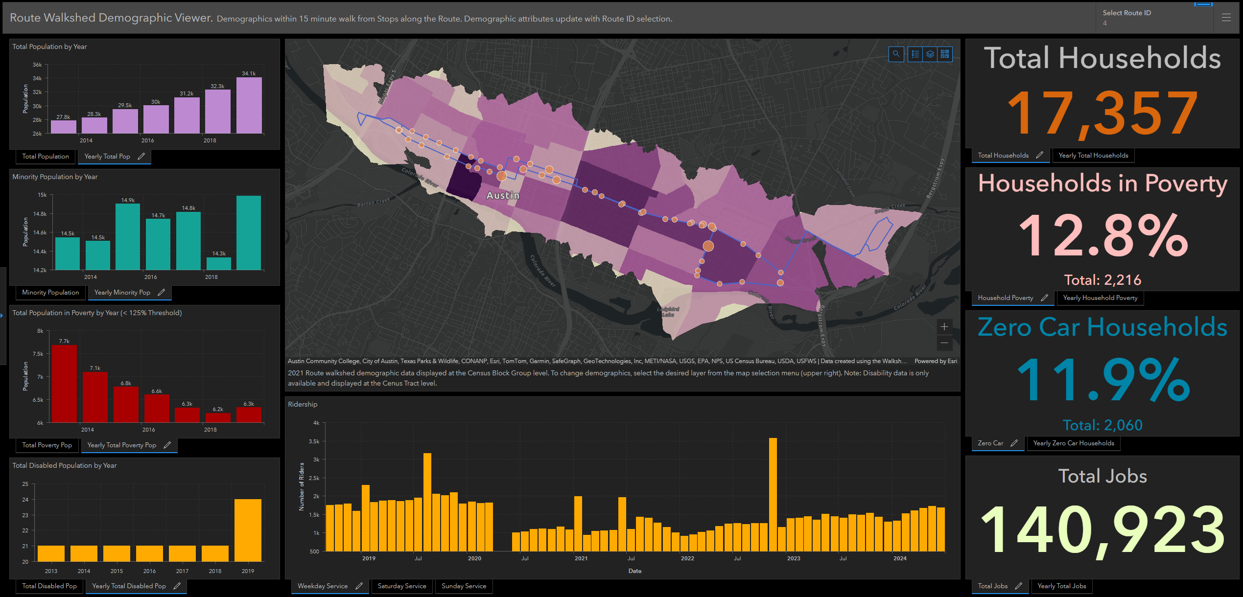 CapMetro route walkshed demographics
Beyond daily transit operations, CapMetro uses FME to tackle complex data integration projects. CapMetro is currently migrating its geospatial platform and using FME to move data into Snowflake, the agency’s cloud data warehouse.
FME simplifies this transition by automating spatial and non-spatial data movement, ensuring minimal disruption and data accuracy throughout the migration process. By using FME with Snowflake, CapMetro efficiently loads between hundreds of thousands to millions of records in just minutes. ArcGIS Enterprise can be connected to data in Snowflake, allowing teams to display data in any format needed.
CapMetro also daisy-chains FME workflows to handle interrelated tasks. For example, after GTFS data is processed, FME triggers other workflows that manage relationships between stops and routes, calculate transfer paths for pedestrians, and update datasets used by transit apps and public-facing maps. These automated workflows reduce manual input, increase accuracy, and ensure that data is always up to date.
Before adopting FME, CapMetro’s staff faced many manual data management tasks, from updating schedules to managing real-time vehicle data. Automating these workflows with FME has saved countless hours, allowing staff to focus on value-adding operations. FME handles approximately 35,000 automations per day, including real-time data processing and large-scale migrations, keeping CapMetro’s operations running smoothly and efficiently.
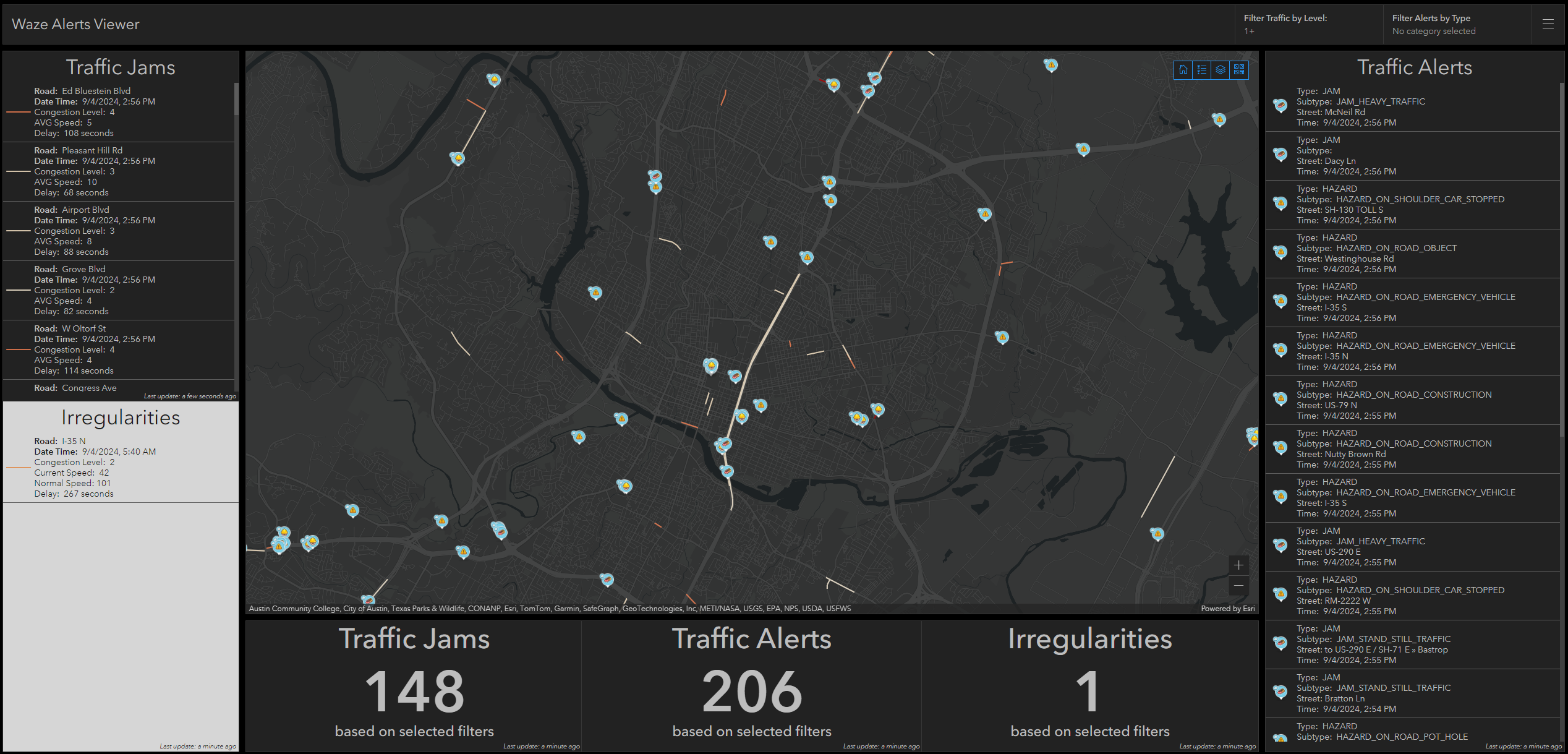
CapMetro Waze alerts viewer
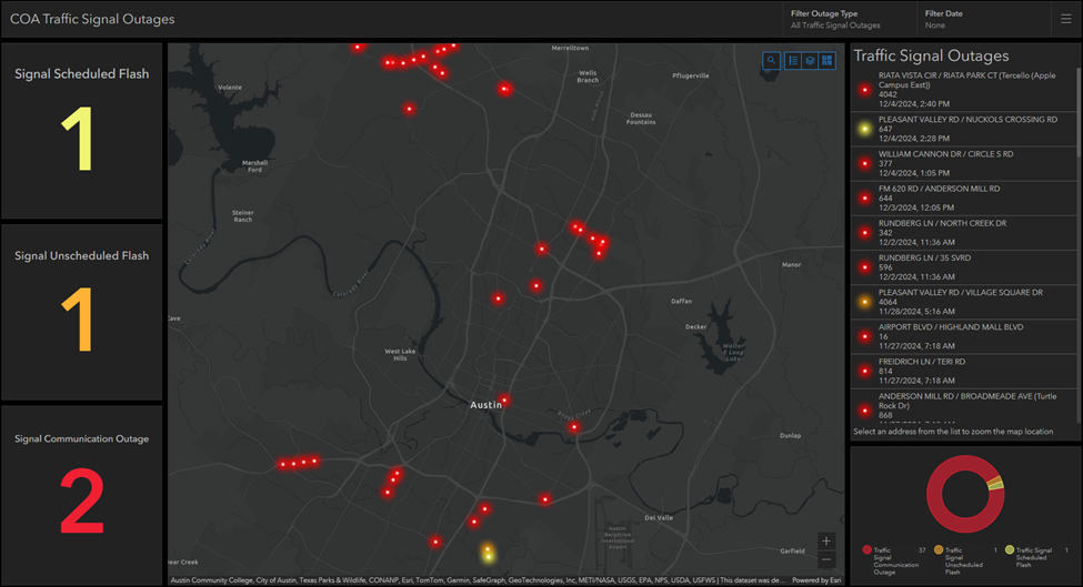 CapMetro traffic signal outage
As CapMetro continues to grow, FME remains essential to its operations, supporting cloud integration and expanded GIS capabilities. By automating processes, enhancing real-time data access, and providing critical insights for future planning, CapMetro ensures that the region’s public transit system remains efficient, reliable, and ready for the future.