
This work was done in collaboration with Safe Software partner GeneGIS GI
Seeing risks before they become disasters
Disasters and complex emergencies can leave a significant mark on the environment. Responding effectively requires quick identification of risks and damages.
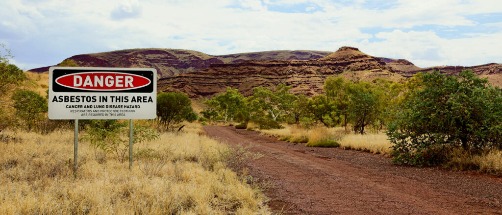
In Northwest Italy near Turin, a former asbestos mine classified as a Site of National Interest has become the focus of an advanced digitalization project to support remediation and environmental protection.
Since 2022, GeneGIS GI has overseen six-monthly environmental monitoring at the site. The work has included aerial photogrammetric surveys carried out twice a year, terrestrial laser scanner surveys, continuous readings from piezometers and inclinometers, and field observations with photos and notes. More than 500 GB of information has already been collected, and the volume continues to grow.
Bringing the field into the cloud
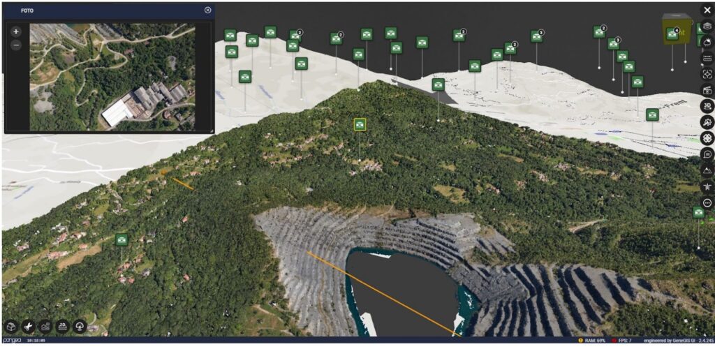
Managing such a large volume of environmental data requires tools that can connect what is happening on the ground with platforms that store, organize, and make information usable. In this project, Pangea Cloud and QField play a central role.
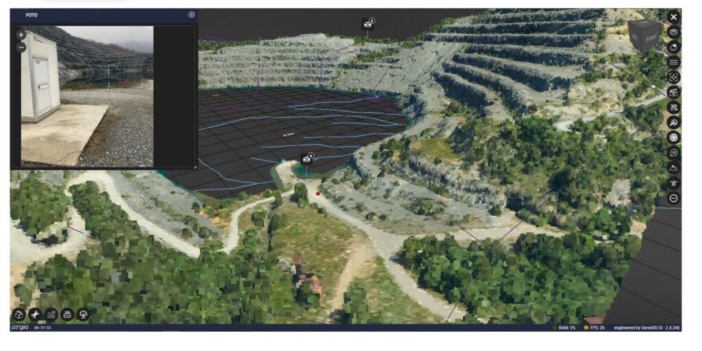
Pangea Cloud, developed by GeneGIS GI, is a web-based platform for managing environmental and infrastructural digital twins. It integrates data collected from aircraft, drones, and satellites with site information, including documentation, photos, video inspections, photogrammetric and laser scanner surveys, as well as vector and raster datasets.
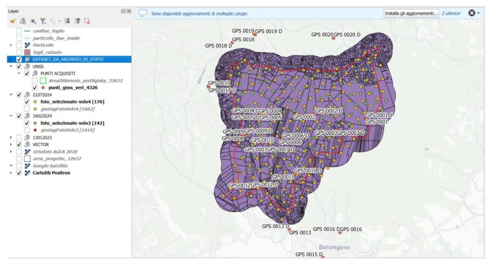
QField is the professional fieldwork app that extends QGIS to mobile devices. With QField, technicians can collect spatial data such as points, polygons, and lines, while attaching multimedia files like photos, videos, and audio. In the asbestos mine project, the app is used to quickly capture field data, map issues and events, and complete attribute forms on-site. Each QField project can later be merged in QGIS for additional processing and uploaded to Pangea Cloud.
Adding AI to the workflow with Whisper
Collecting information in the field is not always limited to measurements, photos, or maps. Technicians often need to capture detailed observations in a short amount of time, and writing everything down can be difficult during surveys. Audio recordings provide a faster way to note information, but they also need to be transformed into usable data.
To address this, GeneGIS GI explored the use of Whisper AI for automatic transcription. Audio files recorded in QField can be attached to survey data and then processed with Whisper. The workflow involves splitting recordings into 30-second chunks, converting them into log-Mel spectrograms, and passing them through Whisper’s encoder.
This made it possible to turn spoken notes into structured text that can be combined with other survey data.
FME as the bridge between systems
With so many different sources and formats, the challenge is not only to collect information but to make it work together in a single digital twin. This is where FME becomes essential. It acts as the integration layer that transforms field data into structured information that can be used directly in Pangea Cloud.
The process is designed to be seamless for technicians in the field. Once data is captured in QField or QGIS, FME takes care of preparing, transforming, and uploading everything to the digital twin environment.
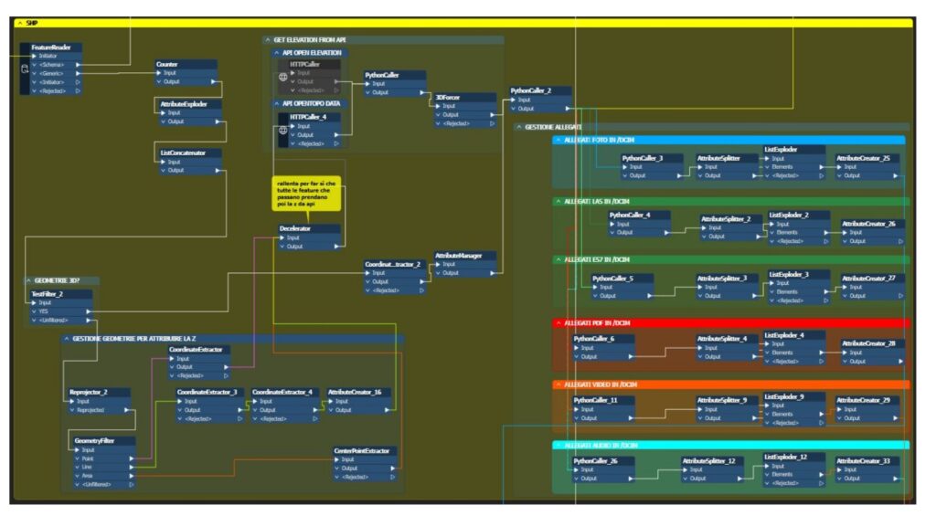
The workflow follows these steps:
- Upload zipped QField or QGIS project folders into FME Flow through a web app or QGIS plugin.
- Split and read files, converting project structures from QGIS (.qgs) into JSON.
- Extract vector styles from QGIS and apply them to items in Pangea Cloud.
- Process spatial datasets such as vector, raster, and point clouds to ensure they are Pangea Cloud compliant.
- Geotag multimedia files including photos, videos, audio, and PDFs using coordinates or EXIF information.
- Create project structures and send them to Pangea Cloud through APIs.
- Notify users of successful uploads through a Telegram connector developed by GeneGIS GI and available on FME Hub.
- Make the entire project and its datasets available for consultation in Pangea Cloud.
Through this workflow, FME ensures that every piece of data , from maps and measurements to multimedia attachments , is transformed into an accessible and reliable resource inside the digital twin.
Turning data into action
By combining Pangea Cloud, QField, and FME, GeneGIS GI has built a workflow where any dataset can be transformed into part of a digital twin. This approach not only supports ongoing monitoring of the asbestos mine but also creates a model for how complex environmental projects can be managed more effectively.
FME makes it possible to bring together aerial surveys, sensor readings, field notes, multimedia, and even AI-generated transcriptions into one accessible system. The result is a living digital twin that supports remediation, monitoring, and decision-making with accuracy and efficiency.
Learn more about the ways FME can help you by visiting the solutions page.
If you want to dive deep into this case, you can see GeneGIS GI in full action at The Peak of Data and AI with their presentation.
They also presented on Automated Rubbersheeting and Data Validation for Multi-Utility Networks Optimization, another great example of how they’re using FME.
And don’t miss the GeneGIS GI partner page to discover more about their journey with FME.