In this Partner Blog Series, Safe Software would like to showcase our partners and their accomplishments. This time, we’ve welcomed Red Geographics to discuss their expertise in cartography and how FME can help you create maps.
Red Geographics is a Safe Software Silver Partner that focuses on FME training and consulting in the Dutch market. In addition to FME, Red Geographics provides cartography services through Avenza’s MAPublisher. Red Geographics also established its own Dutch FME community and created a specialized FME training portal: Red Academy.


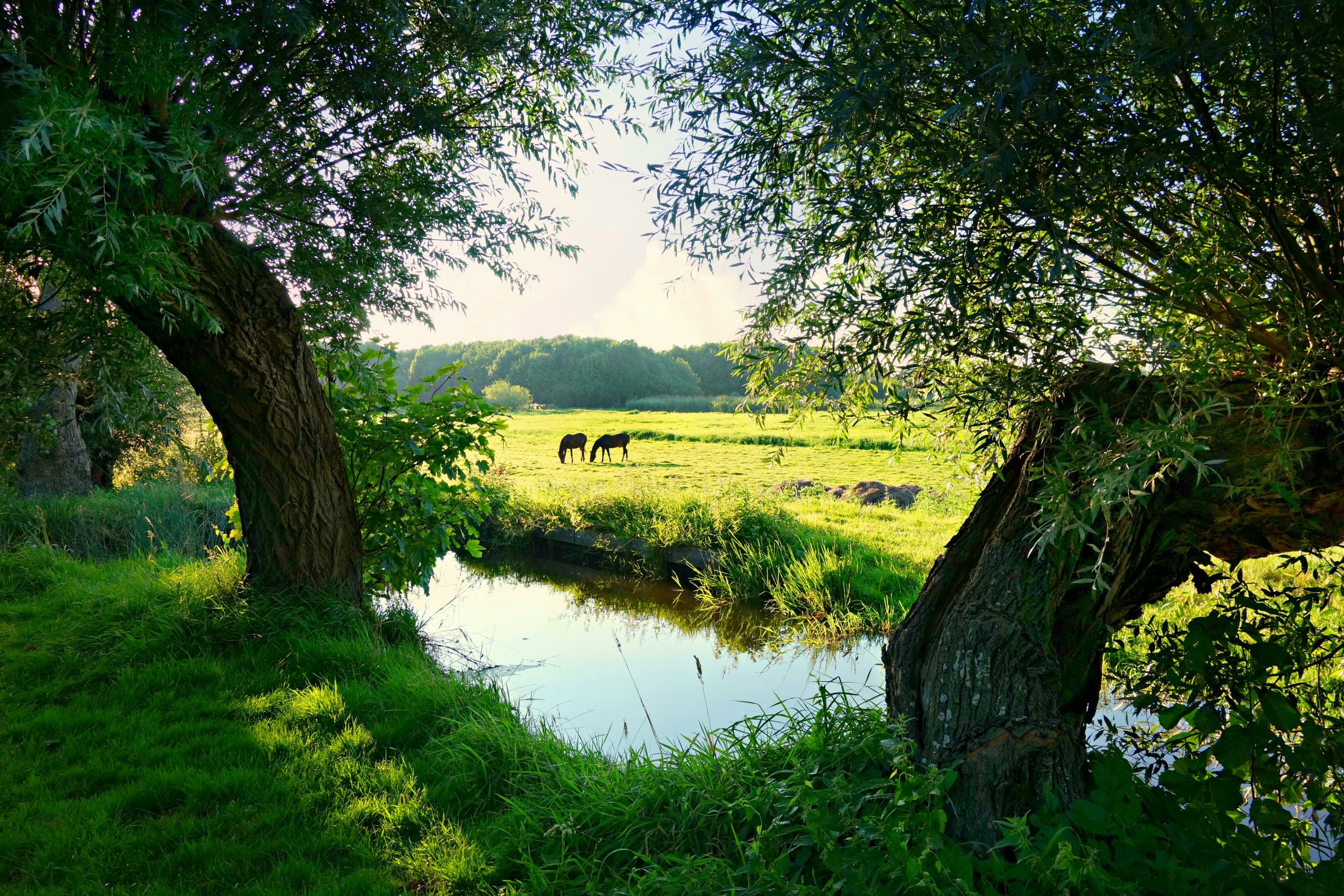
No matter what language you speak, a map will get us to the same place
There are some rumors that maps are at the end of an era. People frequently forget that a map can express many stories without using words. Data visualization on a map is useful not only for planning a simple route but also for delivering the message of what the data is genuinely telling you. Red Geographics combines these two crucial elements. The data and its visualization.
This article examines how FME and its integration with other software have enabled cartography to become a more automated process, presenting a 5-step method for tackling map automation.
1. Prepare the data with FME
FME accomplishes data transformation by combining data from multiple sources. By using Transformers, specific actions are carried out, such as joining, deleting, filtering, or altering data. FME’s strengths are automating processes and integration with other software, like in this case, the integration with Avenza’s MAPublisher.
2. Crafting the map with MAPublisher
MAPublisher is a plugin for Adobe Illustrator. It’s widely used by many cartographers who want to deliver high quality maps with accurate content.
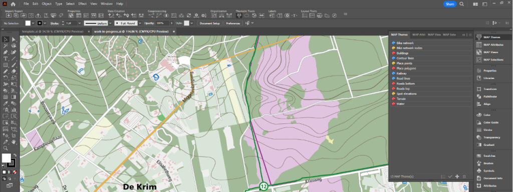
With the plugin, you can create maps with geospatial data, by using its 50+ GIS tools. Effectively combining the design environment of Illustrator with the proper geo-data handling MAPublisher provides.
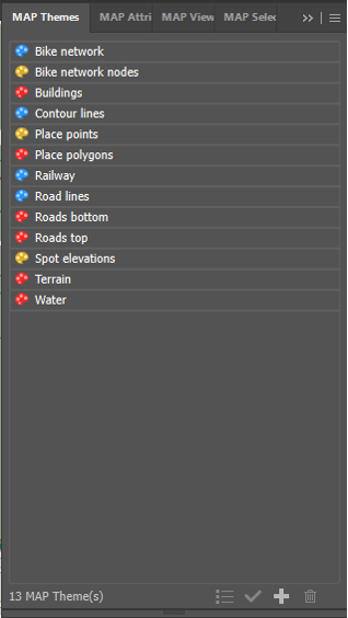
3. Creating MAP Themes to save time and be consistent
Making maps is very much an artistic process and styles have to be defined. When making several maps with the same style, a certain degree of automation is possible. MAPublisher allows you to create MAP Themes: whenever a certain layer is imported, a predetermined style created by the cartographer will be automatically applied to that data directly.
4. Ensure proper data structure for automated MAP Theme assigning
The success of the automatic assigning of MAP Themes depends on one critical factor: the data structure, properties, and layer names must all remain unchanged. It’s much easier said than done.
This is where Red Geographics comes in; with their experience in both FME and MAPublisher, they’ve dealt with this problem countless times.
Pro Tip: FME Auto Plugin
Safe Software designed the FME Auto plugin to help with even more automation. This plugin transports the output of FME’s process directly into MAPublisher. The MAP Themes are immediately applied, resulting in a near finished product within seconds.
Usually, cartography is a time-consuming and manual process. FME Auto takes away the mundane part of making a map. Leaving time for the cartographer to use their skills on the finishing touches. Where manual labor is involved, mistakes are made.
Take into account:
For a map to look good and for the automation process to work, there are several things to take into consideration.
- When making several maps at once, they all need to be saved with their respective, unique, names.
- Layer naming has to be consistent. For example, the layer that contains the terrain, should always be called Terrain. Otherwise, the auto-assign option won’t ‘be activated’.
- The order of the layers is important. Make sure this sorting is already done in FME. Terrain usually is the base of a map. Roads, buildings and waterbodies all come on top of that. After that, it’s text placement. If any of those are not in the correct order, the text is unreadable, or certain objects disappear.
- There must be a template file containing the necessary MAP Themes.
5. Text placement with LabelPro
Text placement might be one of the most time consuming tasks of making a map. MAPublisher features LabelPro. It automates text placement based on user defined rules.
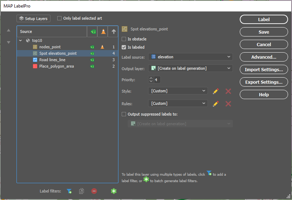
LabelPro has many options for defining rules. This is often trial and error. Keep in mind that it will always be necessary to check and make small edits.
Make sure the data is:
- in the right format
- in the right projection
- in the right order
- in the right scale
- named correctly and uniquely
As MAPublisher is especially equipped to handle geo-data, there are many options for altering data after uploading the data. However, by ‘fixing’ the data beforehand, it’s no longer a question of art versus speed. It’s the best of both combined.
Putting knowledge into action: a real-world example
The example used in the webinar is a cycle network map. In this network, made up of links and nodes, there is a panel with a map on every node. Meaning over 40 maps needed to be made. This project would have taken four days to complete if FME Auto wouldn’t be available. Now, it only takes half a day to finish, with better results.
Red Geographics and FME
Red Geographics offers useful and clever solutions for processing your data, like FME and MAPublisher. Thanks to their 25+ years of experience they make sure to stand out in excellent support, training and consultancy. This does not only mean that they can get you started, but they keep you going as well.
“To power the flow of data, you need to know how.”
Related posts
The Cartographer’s Guide to FME: 6 Steps to Making Beautiful Maps