This story was made in collaboration with Safe Software partner Locus.

Modernizing contamination reporting for faster, more secure outcomes
The Contamination Team at Auckland Council plays a critical role in managing sensitive site contamination information across New Zealand’s largest city. From soil disturbance and land subdivision to fuel tank removal, their work supports safe land use and responsible development.
Each year, the team handles approximately 3,000 internal requests and 600 public queries, of which around 50 require formal Site Contamination Enquiry Reports. Until recently, producing those formal reports required direct involvement from the GIS team.
The process relied on extracting information from 20 separate GIS feature classes, including one major dataset containing 4.8 million records, of which only about 33,000 were relevant to contamination work. Preparing each report involved repetitive data handling, multiple manual checks, and turnaround times ranging from minutes to up to three days. The process had not been revised in several years and included redundant steps that diverted GIS analysts from higher-value projects.
Auckland Council recognized the need for a faster, simpler, and more secure approach.
Enabling self-service reporting
In early 2025, Senior Geospatial Specialist Nick Webber and the GIS team set out to redesign the reporting process. Their goal was to empower the Contamination Team to generate their own reports independently, while strengthening data governance and ensuring consistency with Auckland Council’s GeoMaps platform.
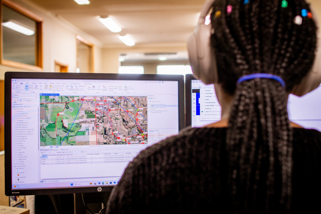
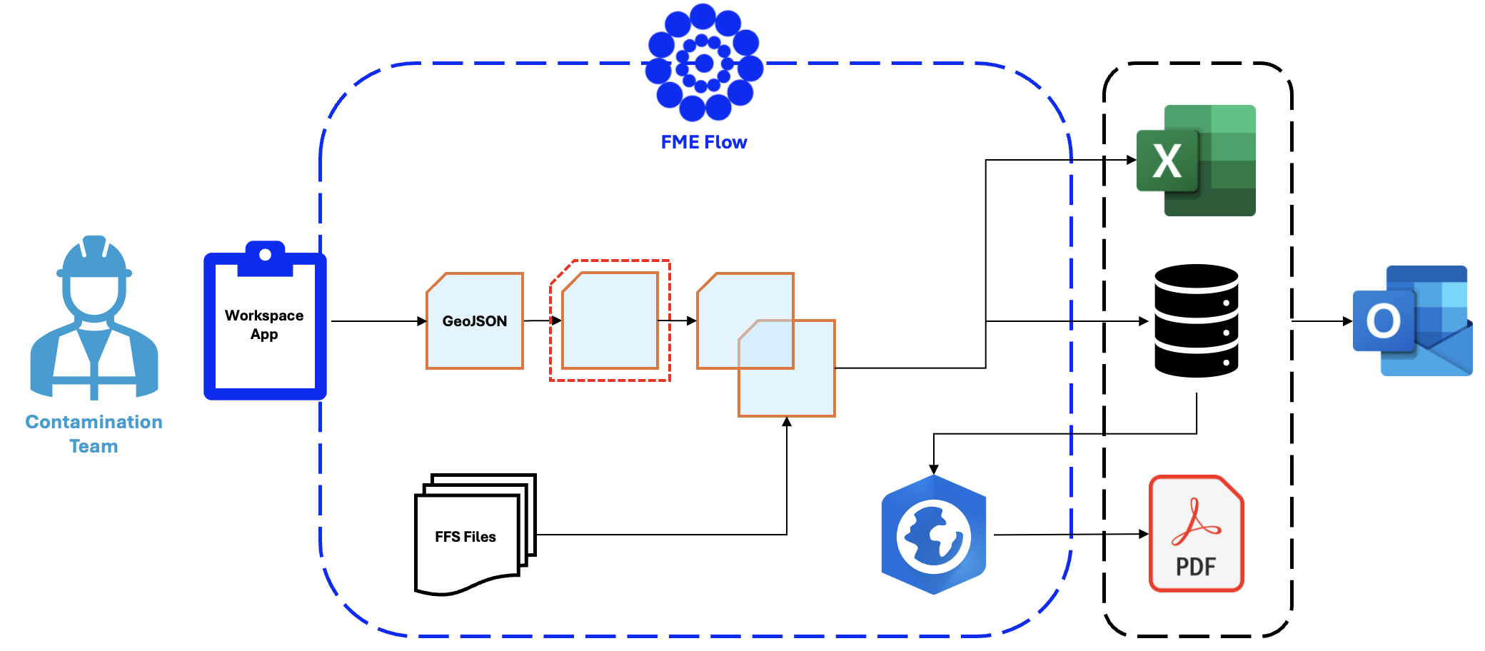
The solution was a self-service Workspace App powered by FME Flow.
Accessible entirely through a web browser, the app allows non-GIS users to submit spatial queries as points, lines, or polygons using the flexible GeoJSON format. Once submitted, the request triggers an automated workflow that generates a contamination report in minutes. No downloads, specialist GIS software, or handovers between teams are required.
Rebuilding the data pipeline
Behind the scenes, the GIS team re-engineered how data is accessed and processed. Rather than connecting directly to Spatial Database Engine (SDE) systems, which risked slow performance and timeouts, the new workflow reads from optimized FME Feature Store (FFS) Files generated nightly from master datasets. These files include only the records relevant to contamination reporting.
The nightly process already supports multiple automation workflows and is designed to scale as additional use cases emerge.
Equally important was ensuring trust and compliance. The GIS team worked closely with the Auckland Council’s Data Governance group to identify and remove fields containing personally identifiable information. By collaborating with the Contamination Team throughout development, they ensured the new reports matched what users see in GeoMaps, eliminating the need for additional manual verification.
Immediate impact across the council
A request that previously required 25 minutes of GIS effort and could take up to three days to deliver is now completed in under two minutes, without any GIS involvement.
Since launching in March, more than 200 reports have been generated through the Workspace App, saving an estimated 250 GIS hours annually. What began as a solution for formal Site Contamination Enquiry Reports is now also used to respond to internal and public contamination queries.
By automating the reporting process, Auckland Council has improved efficiency, strengthened data governance, and freed GIS analysts to focus on high-value work.
Looking ahead
Although originating as a contamination-focused initiative, it’s already emerging as a model for other council workflows. With FME Flow providing the foundation, Auckland Council now has a scalable, secure framework for delivering faster, self-service reporting across departments.
The project demonstrates how automation enhances accessibility, strengthens governance, and modernizes public sector operations, delivering meaningful impact for both staff and the community.