This story was made in collaboration with Safe Software partner Nordend.

Modernizing a tradition of craftsmanship
OpenStreetMap (OSM) is a collaborative, open-source mapping project that provides freely available geographic data to anyone who wants to use, edit, or share it. OSM structures its data through elements such as nodes (points), ways (lines), and relations (groupings), each enriched with descriptive tags.
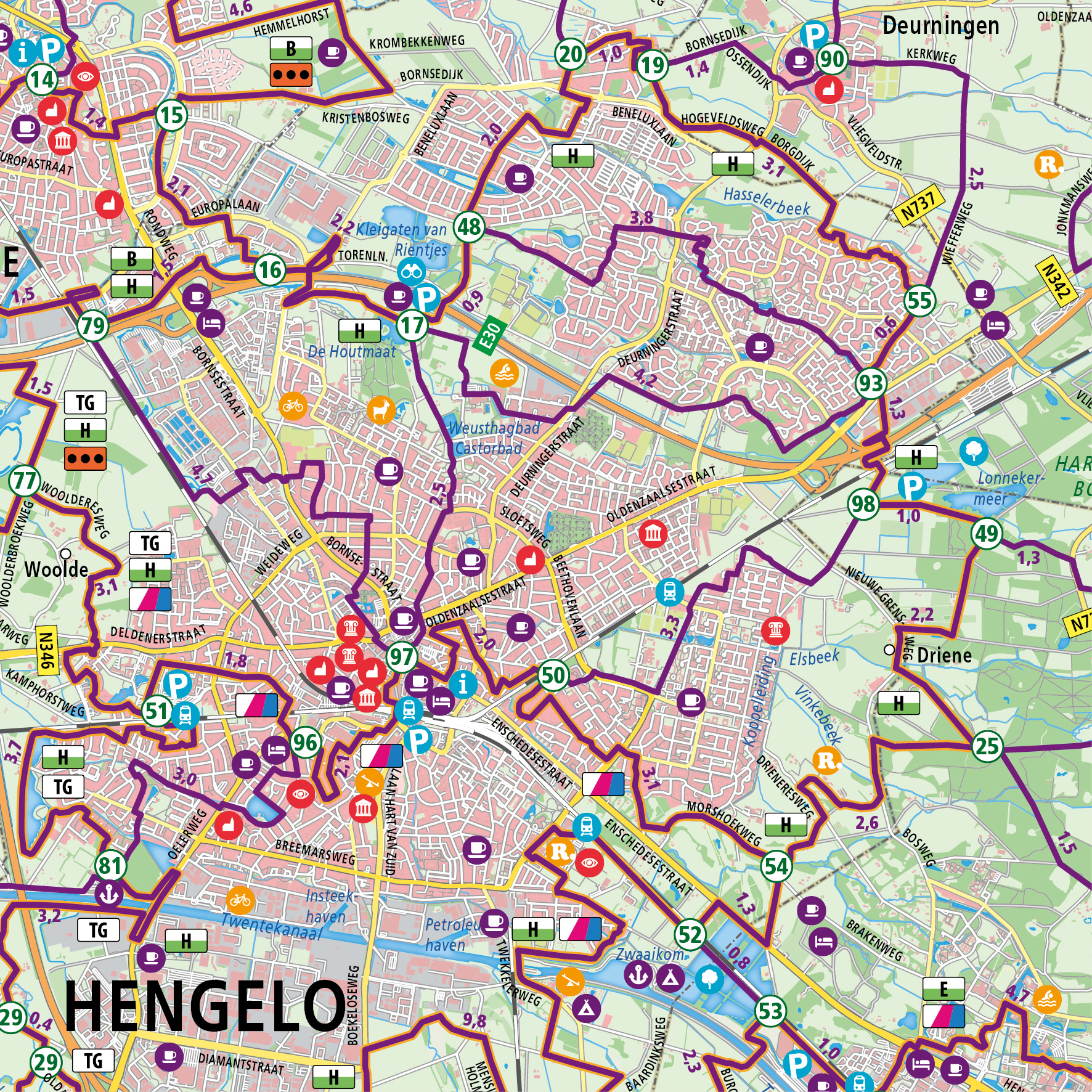
Reijers Cartografie, a Dutch mapmaker specializing in cycling and hiking maps, needed a faster and more flexible way to work with OSM data. The company, recently taken over by second-generation owners Lisa Goes-Reijers and Leon Goes, was looking to modernize production while maintaining the high cartographic quality their clients expect.
While OSM is an extensive and valuable resource, it is also complex and constantly evolving. Reijers Cartografie needed a way to extract only the relevant data, clean it up, and convert it into a format ready for design without repeating the same manual steps each time. To tackle this challenge, they partnered with Safe Software partner Nordend, a specialist in spatial data workflows, to build a faster, automated process.
Turning OSM into a usable map base
To improve efficiency while preserving the high-quality data needed for cycling and hiking maps, Nordend built a solution using FME Form and FME Flow, which was hosted on Microsoft Azure to streamline the structuring and export of OpenStreetMap data.
The new workflow centres around a PostGIS database that stores cleaned and filtered OSM data. Instead of downloading entire datasets—like all of Belgium—Reijers can now select only the area they need. Irrelevant features, such as minor waterways or boundary details, are filtered out automatically, leaving only the elements required for their custom maps. The cleaned data is then exported in a format compatible with Adobe Illustrator, where Reijers completes the final design work.
In order to make this workflow repeatable, Nordend developed a web app that allows Reijers to upload a map selection and instantly receive a tailored dataset. This enables them to create new maps on demand without having to rebuild the workflow, allowing the team to focus on craftsmanship and design, not data preparation.
A scalable solution for fast, high-quality cartography
The result is a flexible, automated system that reduces manual work and accelerates delivery. Reijers can now produce high-quality cycling and hiking maps more quickly, with full control over the look and content. And because the solution is based on open data and scalable technology, it works across borders—not just in the Netherlands, but anywhere OSM data is available.
This collaboration addressed three key challenges: structuring complex OSM data, creating a reusable and efficient workflow, and ensuring the output was ready for high-quality map design. The outcome is a robust, high-performance solution that not only saves time but also gives Reijers full control over their map content, with the flexibility to scale across borders and adapt to any new project demands.