FortisBC automates the assessment of current wildfire threats to its buildings, customers, and gas and electric assets
The frequency and severity of wildfires in the province of British Columbia have been steadily increasing. For FortisBC, the largest natural gas utility and second-largest electrical utility in the region, this means that wildfire management is becoming a year-round effort.
To help prevent catastrophic damage, FortisBC needed a more efficient way to determine the current wildfire threat to its assets and customers so that its Operations Managers could take immediate action.
How they made it possible – no code required
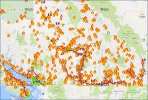
The GIS team used FME to integrate active wildfire data (obtained from the provincial government BC Wildfire Branch via DataBC) into their GE Smallworld environment. They can view all assets within a 10km buffer of the wildfire and analyze every asset interacting with that buffer. The system also provides insight into threats to critical infrastructure, including schools, hospitals and care homes.

FME Flow runs automatically every two hours to match the frequency that the source dataset is updated to keep the information up to date. The output is made available on the server for Operations Managers and Emergency Responders to access via VPN as drawings, reports, plots, Excel files, and KMZ files.
The final integrated view of wildfires and assets allows for better decision-making by FortisBC first responders and the GIS team.


