Key Takeaways:
- FME Realize is an app that lets you visualize and interact with your data through augmented reality on your iOS device.
- Philadelphia International Airport used FME to convert outdated CAD and PDF records into a unified, dynamic GIS database, viewable in AR.
- Clean, validate, and optimize your data with FME transformers for accurate and efficient augmented reality experiences.
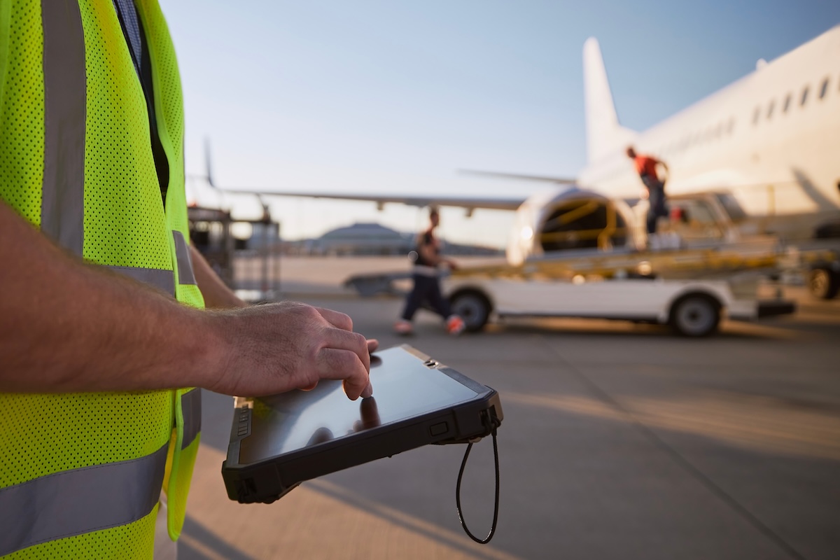
FME Realize connects your digital data to the real world, letting users visualize and interact with spatial data in augmented reality on their iOS device. Instead of studying data on a map or dashboard, field workers can see assets exactly where they exist in the physical environment, such as underground pipes, electrical systems, or structures.
FME Realize can:
-
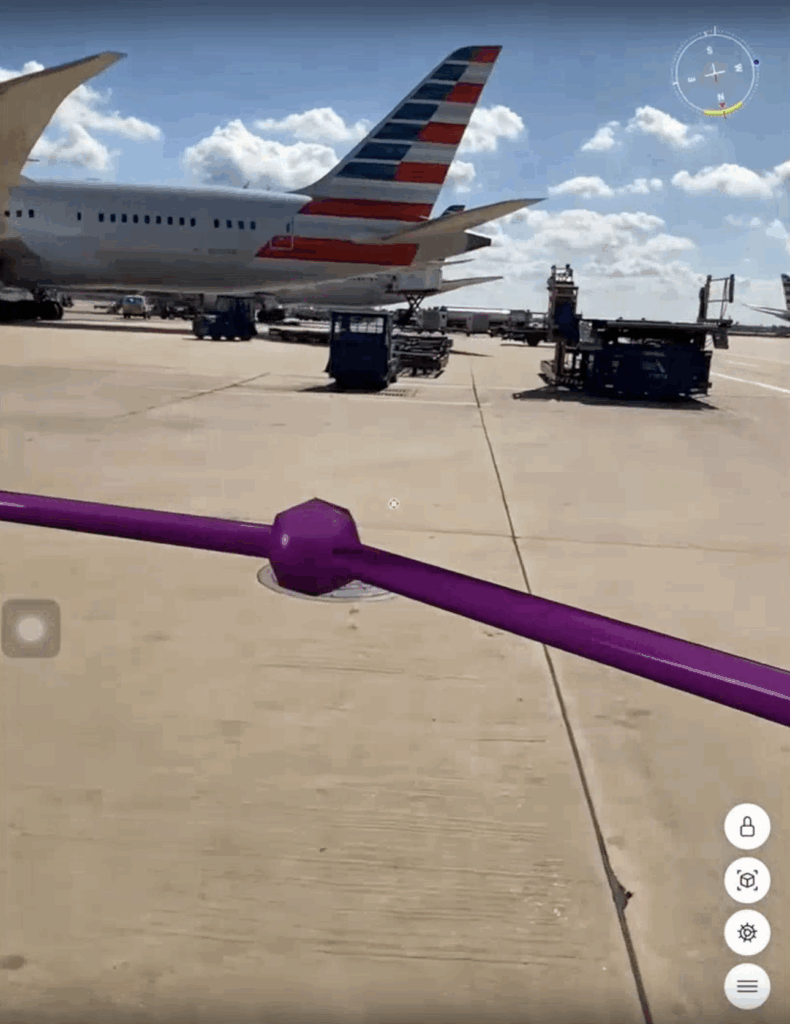
Visualize data on-site: Overlay 3D models and utilities in real-world context.
-
Capture notes and updates directly in the field, syncing changes back to your data source.
-
Verify and QA/QC data visually, catching errors and ensuring spatial accuracy.
-
Work seamlessly with existing FME workflows with no extra coding required.
When Philadelphia International Airport (PHL) was faced with siloed data, including outdated drawings and PDFs, they turned to FME to transform decades of paper-based records into an interactive, living system.
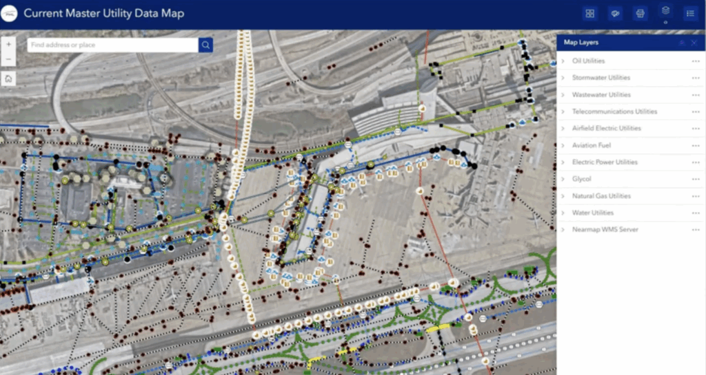
From PDFs to a unified, dynamic GIS database
Managing underground utilities at PHL once meant digging through 75+ pages of outdated, confusing master utility drawings. Updates were rare, sometimes occurring only once a decade. Data was scattered across multiple CAD and GIS systems, siloed by department, and locked in PDFs that couldn’t be searched or trusted. Field crews had to rely on printed drawings or emailed PDFs, with no easy way to verify accuracy in real time.
The airport’s Spatial Services team set out to change that, creating a single source of truth where data could flow seamlessly from engineering to field operations. Using FME, they modernized their Master Utility Drawings into a unified, dynamic GIS database, then brought it to life in AR with FME Realize.
How to get data into augmented reality
Preparing data for AR is done in repeatable FME workflows, where you can use transformers to clean and validate the data (e.g. ensure consistent coordinate systems, standardized units, and valid geometry), convert 2D data like CAD and GIS to 3D models, and optimize for performance. (e.g. simplify complex geometries and filter unnecessary features for quicker loading). Publish the workspace to FME Flow so it can be run on demand and the data visualized in FME Realize.
For detailed step-by-step tutorials, see Getting Started with Augmented Reality and FME Realize.
How Philadelphia International Airport transformed utility management
With help from HDR Inc. and Safe Software, PHL used FME to overhaul their data workflows with several improvements:
-
Validated data integrity using FME to check for missing attributes, incorrect slopes, or elevation mismatches.
-
Automated CAD-to-GIS conversion with custom FME Workspaces, ensuring 3D pipe networks in AutoCAD Civil 3D became accurate GIS layers.
-
Maintained version control through change management processes, tracking every update with AutoCAD Handle IDs.
-
Centralized data access in ArcGIS Hub so staff could view live, authoritative maps.
-
Extended to the field with FME Realize, letting inspectors visualize underground utilities in AR, confirm asset locations, and record updates directly in the app.
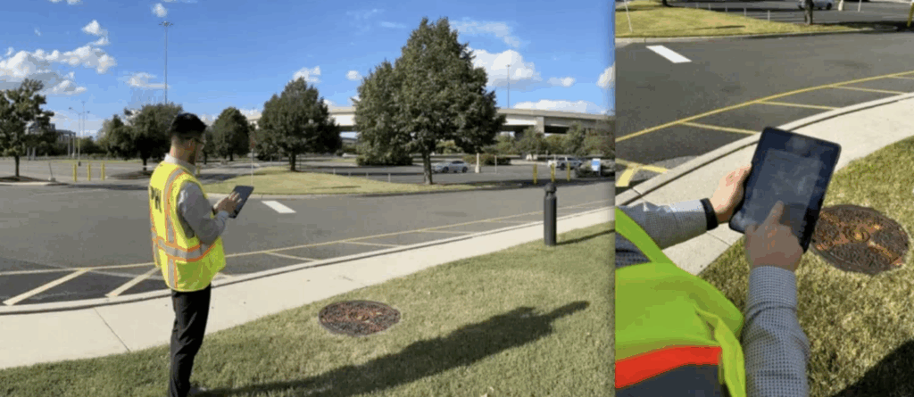
Field crews can now stand on the tarmac and “see” underground pipes and manholes through their iPads. They can tap assets to view inspection records, write notes like “Testing one, two, three,” and instantly see those updates synced back to ArcGIS Online. They’ve successfully created an interactive system with data that’s accurate, current, and available where it matters most.
The power of spatial computing
FME Realize represents the next evolution of spatial data: data you can see, use, and trust. By connecting digital assets to their physical locations, organizations gain:
-
Better quality assurance: Verify geometry and accuracy in the field.
-
Improved safety: Visualize underground utilities before digging.
-
Real-time collaboration: Sync notes and updates instantly between crews and the office.
-
Seamless integration: Use the same FME workspaces that already power your automations.
PHL’s journey demonstrates how spatial computing can modernize infrastructure management and bring long-term efficiency to public assets.
Try It!
Whether you manage utilities, infrastructure, or field operations, augmented reality can help you bridge the gap between your data and the real world. Especially if you already use FME, converting your data into augmented reality is a no-brainer.
Watch our webinar, FME Realize in the Real World: The Power of Spatial Computing in Action, for a deep dive into this topic and fun live demos.