In construction and infrastructure projects, when the difference between success and delay comes down to how quickly data can be processed and analyzed, having the right tools in place is crucial.
In our recent webinar, Globema and AI Clearing discussed a powerful example of how data integration workflows helped streamline spatial data handling in complex infrastructure projects. Here’s a recap of how their solution reduced data processing time from 5 hours to just 30 minutes, with key takeaways that you can start employing in your own projects.
Challenge: Complex spatial data from many sources
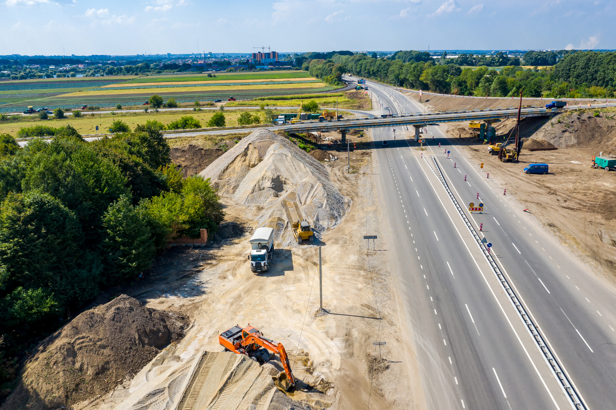
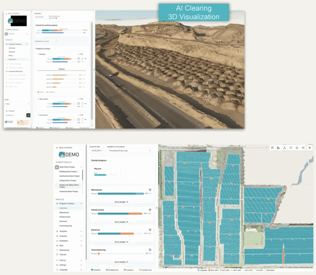
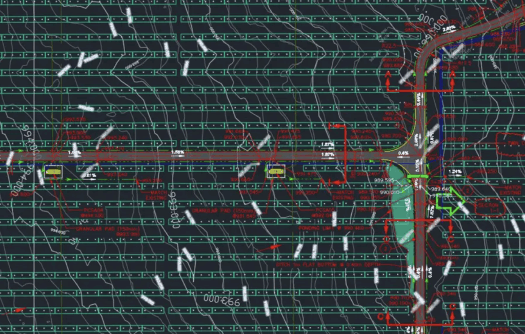
AI Clearing leverages AI and FME to track construction progress and enable real-time quality control. The solution is deployed internationally on large-scale infrastructure projects, such as solar farms, highways, and pipelines. Construction projects involve many disparate data sources, such as high-resolution drone imagery, CAD drawings, GIS layers, and even PDF documentation. With data in dozens of formats like DWG, SHP, KML, and IFC, the challenge is not only volume, but also variety and consistency.
Every week, AI Clearing receives thousands of individual files from different contractors. These datasets must be cleaned, validated, converted, and analyzed before they can be used in AI-driven progress tracking.
Traditional methods were slow and manual, requiring significant time and technical expertise to ensure data quality and compatibility across systems.
Designing a scalable data pipeline
AI Clearing partnered with Globema to build a suite of automated FME workflows to:
- Convert CAD drawings and drone-generated 3D data into usable formats.
- Standardize naming conventions and geometries across multiple data sources.
- Validate spatial accuracy and ensure alignment with project baselines.
- Integrate data with AI Clearing’s cloud-based analysis platform.
This significantly reduced manual effort and data preparation time from 5 hours to 30 minutes per construction site, allowing them to monitor project progress more frequently and with greater consistency.
That time savings translates directly to faster decision-making, more accurate reporting, and the ability to scale operations across dozens of international projects simultaneously.
Key outcomes included:
- Rapid data onboarding: New sites can be integrated into the analysis system within hours.
- Data integrity checks: Errors and inconsistencies are flagged automatically, reducing manual QA.
- Format versatility: FME handles everything from 2D CAD drawings to complex 3D point clouds and PDFs.
- Seamless AI integration: Cleaned and validated data feeds directly into AI Clearing’s machine learning models for progress tracking and anomaly detection.
Customer story: Learn more about AI Clearing’s project
For projects that require integrating diverse spatial data types, this case study offers practical strategies for reducing overhead and scaling analysis workflows. Data integration workflows help standardize inputs, validate incoming files, and streamline team handoffs.
- Eliminate bottlenecks caused by manual processing.
- Improve data quality and consistency across teams.
- Accelerate project timelines with faster insights.
For a deep dive on this topic, watch the webinar: No-Code Workflows for CAD & 3D Data: Scaling AI-Driven Infrastructure.