Spatial data, also known as geospatial data, is a term used to describe any data related to or containing information about a specific location on the Earth’s surface. It includes geographical coordinates and other forms of locational data. Non-spatial data is data that is independent of geographic location. Both types of data can exist in a variety of formats.
Spatial data types
Spatial data can also contain more than just location-specific information. To properly understand and learn more about spatial data, there are a few key terms that will help you. Here is a helpful article of acronyms that you may come across.
Vector data
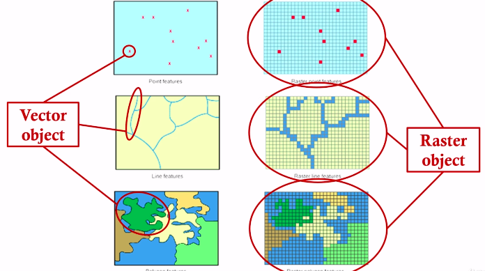
Vector data is used to represent geographic features using points, lines, and polygons. Common file types include Shapefiles (.shp), GeoJSON, KML, and GML.
Raster data
Raster data is represented as a grid of pixels. Each pixel within a raster has a value, such as that cell’s colour, height (z), or temperature value. Rasters can represent images or other forms of continuous data, such as digital elevation models (DEMs) or orthoimagery taken from satellites and other aerial devices.
Spatial Data Terms and Components
Geographic Coordinate System
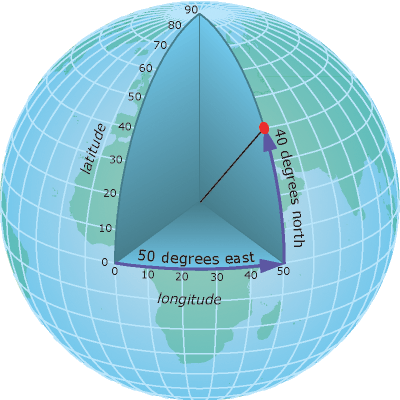
To identify exact locations on the surface of the Earth, a geographic coordinate system is used. In geography, the axes are referred to as lines of latitude (horizontal lines that run east-west, parallel to the equator) and longitude (vertical lines that run north-south, connecting the poles). Each axis represents the angle at which that line is oriented with respect to the centre of the Earth, and so the units are measured in degrees (°).
Georeferencing and Geocoding
Georeferencing and geocoding are different. However, they are similar processes. Both involve fitting data to the appropriate coordinates of the real world. Georeferencing is the process of assigning coordinates to vectors or rasters so they can be oriented accurately on a model of the Earth’s surface. The data used in geocoding are addresses and location descriptors (city, country, etc.). Each of these locations is given the coordinates of reference for that location on the surface of the Earth.
Attributes
Any additional information that describes a data feature is referred to as an attribute. For example, you might have a map displaying buildings within a city’s downtown region. Each of the buildings, in addition to their location, may have additional attributes such as the type of use (housing, business, government, etc.), number of storeys, etc.
LiDAR and 3D Data
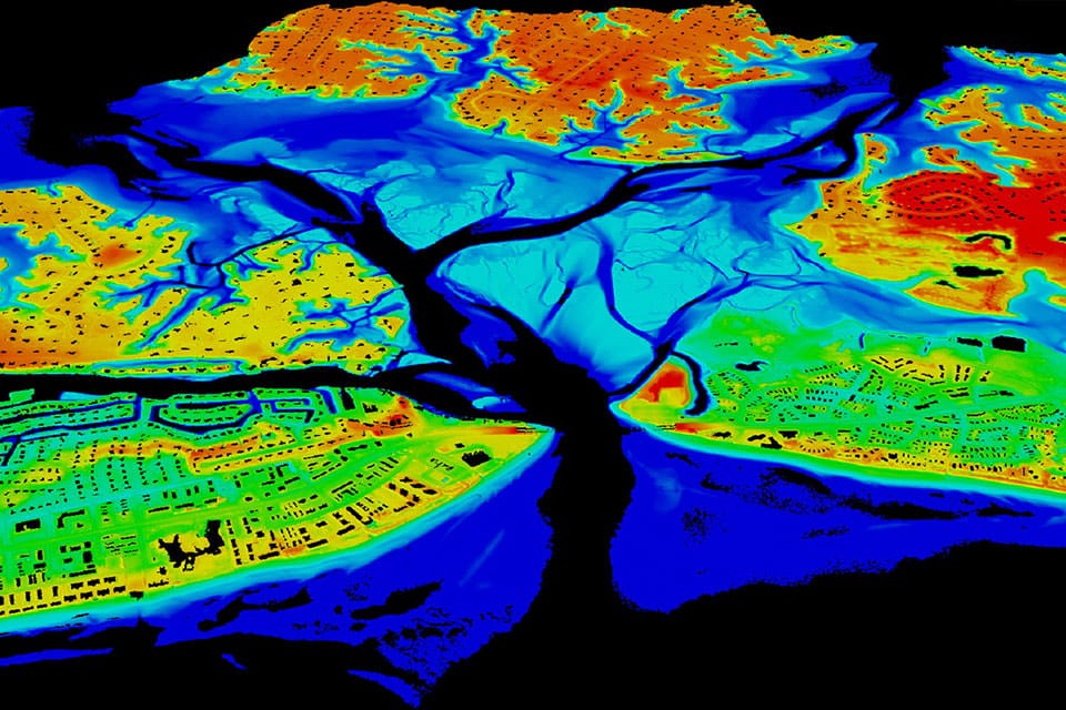
In addition to raster and vector data, there is also LiDAR data (also known as point clouds) and 3D data. LiDAR data is collected at different points and measuring the return times for reflected laser light. This infers distance and eventually a 3D position. 3D data incorporates elevation and/or depth. While complex, this data is rich with information. 3D data can be used to solve a variety of problems pertaining to the Earth’s surface.
CAD and BIM
CAD (computer-aided design) and BIM (building information model) data formats include many spatial elements and are often used in architectural, engineering, and construction (AEC).
Non-Spatial Data
Non-spatial data, simply, is data that contains ‘what’ instead of ‘where’. As mentioned above, it is independent of geographic location.
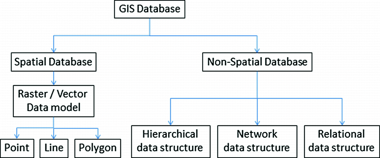
An attribute could contain both spatial and non-spatial data. Non-spatial data can help put spatial data into more context. It is characteristic data. This could be someone’s height, for example. It has nothing to do with their location. The difference in structure is highlighted in the image below.
You might also want to read:
Navigating Non-Spatial Data Migration
FME and Spatial Data
FME for Spatial Data Integration
While there are many tools and software that can help you make use of spatial data, FME is the software of choice for those that need to integrate their spatial data. Safe Software and FME came into existence to solve this problem. Spatial data varies widely. It is often stuck in formats that cannot be easily used by all applications. This makes it extremely difficult for GIS experts to make use of all the information they have. While it was possible to transform proprietary formats in the past, much of the data would be lost in the conversion. Thus, FME was born.
With a greater ability to connect and transform your data, you’ll be able to solve data challenges more effectively and efficiently. Learn more about FME today!


