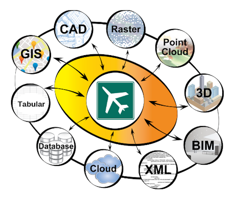
A lot of teams, systems, and real-time updates are involved in an airport’s day-to-day operations. Facilities maintenance, asset managers, security, and other teams all have their own datasets. Construction, aircrafts, and passenger volumes are constantly changing and increasing. An airport might have CAD and BIM data representing the indoor spaces, GIS data representing the outdoor space around the airport, XML for airspace data, asset management systems like IBM Maximo, facilities management systems like IBM TRIRIGA, and much more. Keeping all of these moving pieces coordinated is key to the safety and operational efficiency of the airport. This means all datasets need to have the ability to respond to live events and reflect changes in other datasets.
Synchronizing and sharing data across airport systems can be done with the help of a data integration tool like FME. Here are the steps involved.
Step 1. Build a data integration workflow to connect data across the airport
The first step is to connect data across different teams using an FME data integration workflow. Many airports choose to bring data together into a single source of information (like LAX did to improve situational awareness and enable a mobile reporting tool). Other airports prefer to keep their systems separate, and build workflows to ensure each system reflects the latest information in the other ones. In any case, it is recommended that these integration workflows incorporate data validation steps to ensure all data is correct and complete.

Step 2. Synchronize automatically
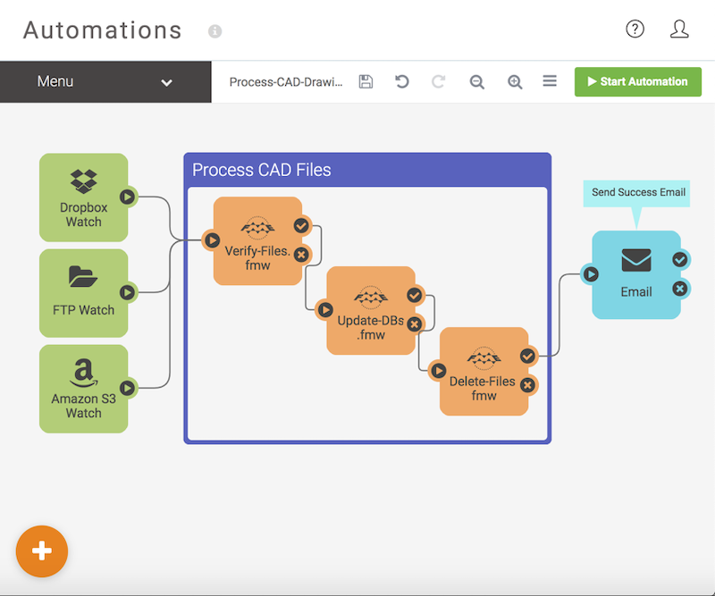
Once data integration is in place, running it as part of an event-based workflow ensures all systems stay up to date. Some airports choose to integrate data on a schedule, e.g. nightly like YVR does, while others choose to trigger integrations only as needed, e.g. whenever a particular dataset gets updated.

Learn how Denver International Airport created a unified system for BIM/GIS data, generated an interactive online map, and kept all of their systems up to date with their active construction projects. View presentation slides
Bonus: Generate notifications, indoor maps, and more
Now that automation is in place, it’s easy to take your airport’s operations a step further. For example, you could set up a notification system – say to generate data validation reports for teams to review the quality of their datasets, or to notify passengers of an important change via their mobile devices. You could also set up an automated QA system to validate submitted data from contractors and ensure it adheres to corporate CAD or other standards.
More and more airports are also sending an integrated version of their floor plan and asset information to an indoor mapping provider, like Apple Maps or HERE, to make their airport available for indoor wayfinding.
Indoor navigation is quickly becoming essential for airports, as it improves passenger experience, helps airport staff track assets, and can even help an airport understand space utilization so they can understand where to put new shops to maximize revenue.
- Learn how Amsterdam Airport Schiphol used FME to offer data to the public via open APIs, enable indoor mapping, build an augmented reality wayfinding app, and create a digital twin of the airport — resulting in a multi-award-winning passenger experience. Watch the webinar
By building an FME data integration workflow and synchronizing all systems, top airports around the world have improved their facilities management, passenger experience, and safety. Data synchronization is just one way FME helps airports. Learn more about data transformation for airspace analysis and other use cases at safe.com/airports
Further reading: How 4 award-winning airports use indoor mapping to create the best passenger experience. These airports have built custom web apps, generated IMDF for Apple Maps, enabled augmented reality wayfinding, and more, all using data integration workflows.


