
More than a few “Best Of” science fiction compilations include Poul Anderson’s story “Call Me Joe”, in which the main character explores the surface of Jupiter by remotely controlling an artificial life form designed to survive the planet’s hostile environment. Who knew in 1957 that the day would come when we’d really be exploring another planet from here on Earth? Or, for that matter, that Fred Judson, GIS Coordinator at the Ohio Department of Transportation, would be remotely controlling an aerial photography plane from a laptop in a field in Ohio? And that FME would help?
F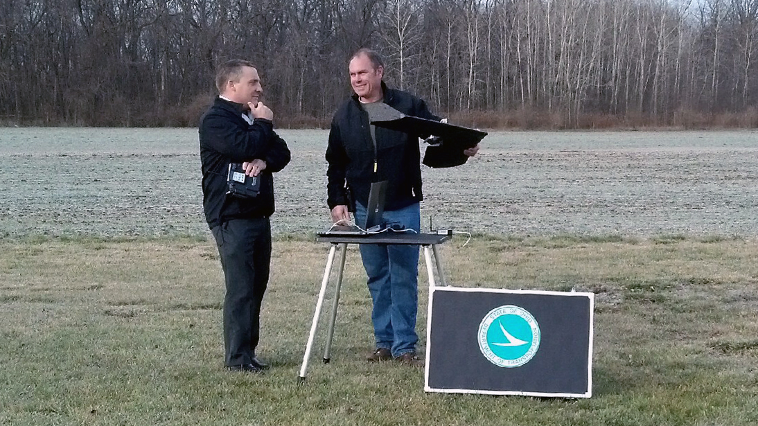 red and his colleague Ben Cordes, GPS Coordinator, were looking at new technology one day, joking about an affordable one-pound Styrofoam aerial photography plane that flew itself, when they realized that if it actually worked as advertised, it could really be a valuable addition. Sure enough, after doing their homework, it looked like a truly viable option – and so the Ohio DOT became the proud new owners of a senseFLY swinglet CAM.
As virtual co-pilots Fred and Ben went through training, they soon realized that even though the remote surveyor usually operates under 400 feet above ground, the rules governing its usage are very much like a private aircraft under visual flight rules, and so they turned to FME to help them build and manage their flight plans. First, they identify their project area, and the swinglet CAM’s software generates a proposed flight path. That gets fed into an FME workspace, which also reads FAA airport data, checks for restrictions such as distance from aerodromes, and identifies any conflicts.
The workspace then creates a hull around the final flight lines, converts above ground heights into above sea level heights, and converts required coordinates to the FAA’s preferred degrees-minutes-seconds format. These results go into an authorization form, much like a flight plan, for FAA approval, which is accompanied by a KML version of the flight.
 That data also gets uploaded to the internal SQL Server database, so anyone within the DOT can see where coverage will be available. The flight data – including KML and an FME-generated coordinate spreadsheet – is also provided to the local Air National Guard. With approvals in hand, Ben and Fred head out into the field and take off.
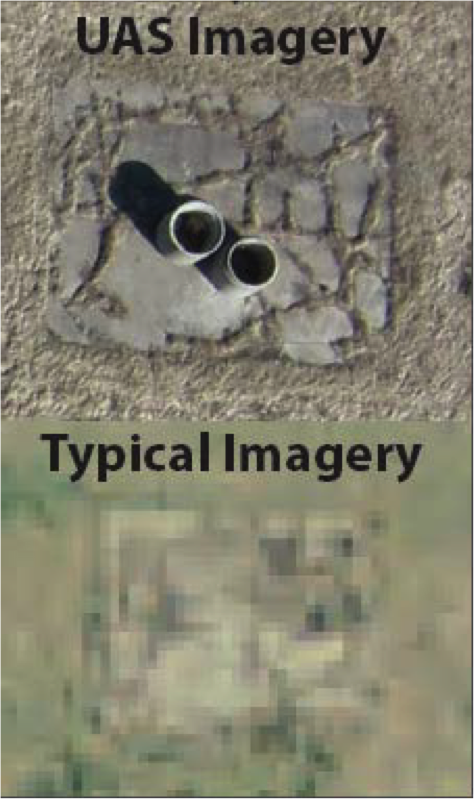
Now that they’ve started collecting their own imagery, FME will be assisting with image mosaicking and format transformations. And as the results also include the affordable production of 3D terrain data, they’re looking at other new technologies too – even the possibility of using 3D printers to create models of proposed works for stakeholder reviews. As Fred told us, “This is about being able to acquire data right now – when we need it. We can fly a pre-construction survey, monitor a project for compliance, and as-built it afterwards, at a fraction of the cost of using a conventional aircraft.”
The latest developments are coming through additional post processing of the imagery, creating Esri ARC grids and overexposing the images to enhance the pavement for crack detection. We’d like to add Fred and Ben to our “Best Of” list for embracing new technologies, and are proud that FME is part of the team.
Read local news coverage here: http://www.13abc.com/story/22186538/o-dot-using-tiny-technology-on-big-projects