This story was made in collaboration with Safe Software partner Seamless.
![]()
Building a single source of truth for network information
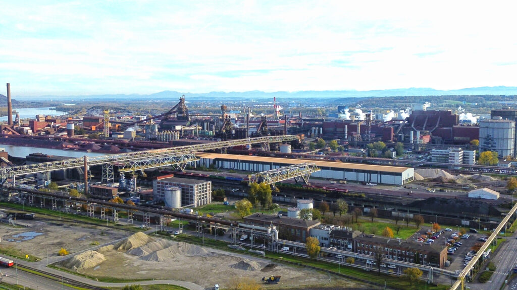
Network Waitaki is an electricity distribution business serving New Zealand’s North Otago region. As the organization continued to evolve into a more digital utility, its legacy GIS system began to reach the limits of what it could support.
While still functional for core operations, the system was not designed for broader organizational access, modern integrations, or future digital utility needs. Teams that needed GIS information often had to use ArcMap, a desktop tool that required specialized knowledge and was difficult for non-GIS users to navigate.
“There was no easy way to put all our network information sources in one place,” recalls Sahil Bhouraskar from Network Waitaki’s Network Information team.
With Esri Geometric Network set to be retired in 2026, Network Waitaki took the opportunity to modernize its GIS environment by migrating to ArcGIS Utility Network. Working with Seamless and Geovolve, the organization created a new foundation for network data, accessibility, and future system integration.
Expanding GIS across the business
With the Utility Network in place, GIS evolved from a specialized tool used by a few technical users into a business-wide platform supporting teams across the organization.
Network Waitaki can now create web apps and user-specific maps that make GIS information easier to access and understand. Outage managers, planners, engineers, asset maintenance teams, field crews, and customer service teams can all access relevant network information through more intuitive, browser-based tools.
“Now I can say that outage managers, planners, engineers, asset maintenance teams, field teams, customer service, everyone uses GIS across the business, in some way or other,” says Sahil. “It’s a big change.”
The new platform also improves data accuracy through built-in validation rules. Connectivity errors are flagged as they occur, helping users resolve issues immediately and maintain a more reliable network model.
“What we have is an analysis-ready model that is self-regulating,” says Sahil. “It’s more accurate, and the models are more reliable.”
Automating outage planning and system integration with FME
FME plays a key role in connecting Network Waitaki’s GIS with other business-critical systems, including ArcGIS, DIgSILENT PowerFactory, and future ADMS workflows.
One of the strongest examples is outage management. Previously, outage planners manually copied and pasted customer connection information, known as ICPs, and other relevant data into spreadsheets to determine which customers would be affected by planned works.
Now, using a web app powered by FME, the team can simulate a network outage, trace the network, identify affected customers, and feed that information directly into the outage management system and customer notification workflows.
This has replaced a time-consuming manual process, saving the team tens of hours each week.
By consolidating data from multiple sources and keeping it accurate and up to date, FME helps ensure teams across the business work from a single, trusted source of truth.
Supporting smarter network planning
FME also supports Network Waitaki’s engineering and planning workflows by helping connect GIS data with DIgSILENT PowerFactory, a load flow analysis tool used by the network planning team.
Previously, planners followed a more manual process in PowerFactory, replicating network capacity information from GIS. This was time-consuming, and earlier attempts to automate the process with custom scripts were difficult to maintain and update.
With FME, data can now be pulled into GIS and kept current, enabling planners to work with more accurate, up-to-date network models. This improves confidence in planning decisions and supports higher-fidelity modelling down to the terminal and node level.
The GIS also brings together additional context, including land parcels, council information, and environmental data. This gives engineering teams a more complete view when planning work, assessing constraints, or designing infrastructure in areas such as floodplains.
Enabling self-service access for customers and field teams
As GIS became more widely adopted internally, Network Waitaki also began extending network information to customers.
The organization now provides public-facing network and hosting capacity maps, allowing customers to self-assess factors such as available network capacity and the power they can export from solar or wind generation. Supported by FME, these maps provide customers with access to current network information without relying on manual requests.
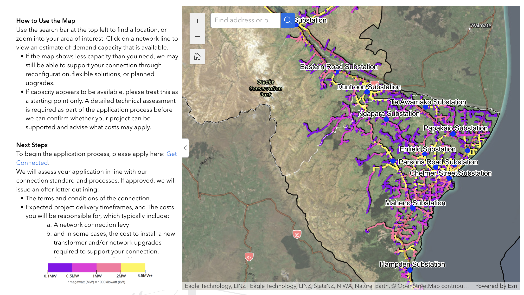
Public-facing network capacity map powered by integrated GIS data.
This replaced a more manual process between customers and the Network Information team, reducing internal workload while improving access to useful network information.
Additionally, Network Waitaki offers a public outage map where customers can check upcoming planned works in their neighbourhood. In the past, a map of this capability would have required significant custom development or been deprioritized due to technical barriers in the legacy GIS platform.
Field crews have also benefited from mobile access to GIS data. Previously, teams relied on paper maps, local knowledge, or disconnected information sources. Now, they can view asset information in the field, verify details before beginning work, and record updates directly in the system. This improves spatial awareness and gives users greater confidence when locating assets or understanding what may be affected by network switching.
Creating a foundation for future utility operations
With GIS now used consistently across the organization, Network Waitaki is continuing to build toward a more connected digital utility.
The Utility Network serves as the organization’s connectivity model, feeding information into other systems and creating a more reliable foundation for future initiatives. FME helps support this vision by integrating data across systems and ensuring information remains consistent throughout the business.
This foundation will support future projects such as an Advanced Distribution Management System (ADMS), enabling enhanced outage response, improved switching operations, greater situational awareness, and more intelligent grid management.
“We do it once, and we do it right, and then it feeds out into other systems,” says Sahil. “That’s where FME plays a part, integrating between the systems.”
What began as a GIS modernization project has evolved into a connected platform that saves teams time, improves decision-making, and provides a foundation for future utility operations.