Geospatial Education and Minecraft: Niagara Falls


 Students in Niagara College’s GIS – Geospatial Management program have a great opportunity – to work on a year-long thesis project, collaborating with real employers to design and implement a real-world GIS project.
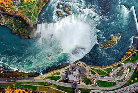
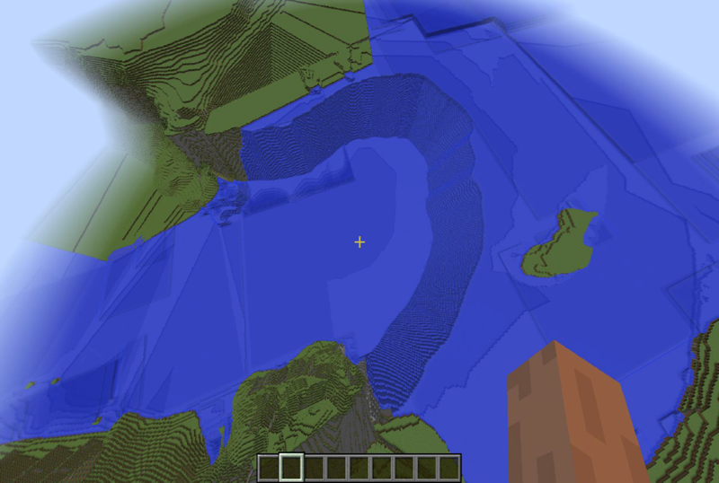
This year, one of those projects was put forth by Geospatial Niagara founder and CEO Darren Platakis. He’d seen various Minecraft initiatives going on around the world, and thought that it had great potential as an educational tool. And with one the world’s most recognizable natural features nearby, why not map the region and the famous Niagara Falls in Minecraft?
And when students Bogdan Oros and Adriana Ruiz saw it on the list of potential projects, there wasn’t anything else they wanted to do.
Getting Started – Without FME
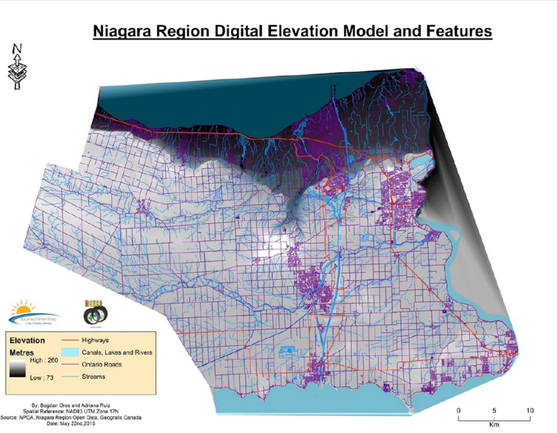
The first order of business was to find their source data. Between the Niagara Peninsula Conversation Authority and the Government of Canada’s GeoGratis, they sourced a DEM of the region, topos, and shapefiles of the road network and hydrology. Initial data prep was done in ArcGIS, creating a layout with classifications on the roads and hydro datasets, clipping it all to the target region, and generating a final DEM.
Up to this point, they didn’t know about FME’s Minecraft capabilities. They had never used it, either, but the Geospatial and Minecraft – Why You Should Care webinar back in February changed everything.
Getting to Minecraft
Through the webinar, Bogdan and Adriana got in touch with in-house FME Minecraft guru Dmitri Bagh, who helped them through their first workspaces. They encountered similar challenges to other projects like this – dealing with vertical height constraints imposed by the format, and simple sheer volume of data.
What’s Next?
With the final world coming in at around 50 gigabytes, Bogdan and Adriana have further processed it to divide it into municipalities. The next step is to share it, and Geospatial Niagara will work with local school boards to help make it available in a classroom setting as a geographic teaching tool where kids can even contribute to it through adding structures.
They also have even grander plans, and it involves going underground to incorporate bedrock geology – which users will be able to dig down to.
“The sky’s the limit for the utilization of the Niagara Minecraft maps for education beyond geography. Geospatial Niagara is very happy to announce that we have become a member of the ihub community as an ihub tenant. The Educational Research and Innovation Hub (ihub) facilitates connections between educators, students, researchers, entrepreneurs and educational technology companies to support the development of innovative educational tools. We look forward to working with the various ihub partners such as Innovate Niagara, the DSBN, Brock University and Niagara College to move the Niagara Minecraft map forward. We have made some valuable and exciting connections and plans are definitely in the works. More public announcements are coming soon.”
–Darren Platakis, Geospatial Niagara
Adriana tells us this about her experience. “I think that the key factor of the Minecraft project was teamwork. Our Professors from Niagara College, Darren Platakis from Geospatial Niagara, and Dmitri Bagh from Safe Software were always very supportive. I believe that this innovative tool will awaken children’s curiosity and creativity when exploring the region because it allows you to see the Niagara Region from a virtual perspective which is really fun.”
And it seems that outlook is gaining traction both in the spatial community and wider world. This recent article from NPR, Sometimes A Little More Minecraft May Be Quite All Right, touches on how it can assist in teaching spatial reasoning and even engineering concepts.
“Education has gone beyond lecturing – students need engaging and immersive lessons to keep their attention to the topic at hand. Geography can be taught in a very fun and entertaining manner, different than any other subject. Minecraft gives a boost in the method that teachers can deliver their lessons,” says Bogdan. “As a teacher I can attest that this brings a whole new quality to teaching. It is the educators’ responsibility to seek how this game and world can aid students and as such create a lesson plan or hook around it to take full advantage of its ability. Prioritize fun and the learning will come.”
As an aside, we’re always happy to support projects like this one with software licenses through our Academic Grant Program for Students. And we love to see what the next generation of spatial pros does with them – great work!


