Real-time Editing of a Spatial Database


Two years ago I wrote a blog post on bringing real-time data to the web. In the post I used three technologies—Node.js (with some server-side code), pusher.com, and FME Server—to enable users to make edits to polygons on one map, which updated a spatial database and pushed the changes out to all other users in real time. In effect, a lightweight GIS editor.
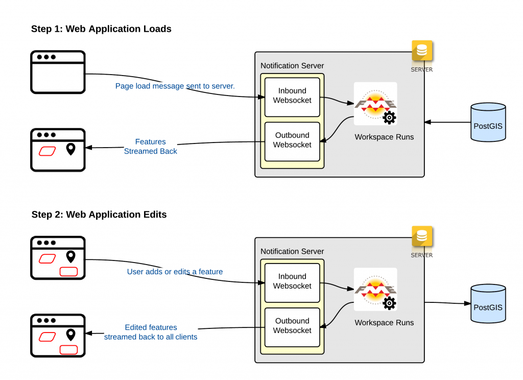
Roll forward 2 years and we have recreated the same functionality, but this time with only one piece of technology: FME Server! With the WebSocket server included in FME Server, it is now trivial to write applications that allow users to make changes to datasets in the web application, update the spatial database, and then push the new updates out to all users with the application open. This particular example uses two workspaces to power the application. Between both workspaces there are less than 15 transformers! Remember with FME Server you are not tied to a specific mapping platform. We used Google Maps in this demo but you could easily use Mapbox, ArcGIS Server, Bing Maps, etc.


